Tissamaharama
A small town on an ancient reservoir in the deep south, about 16 km by road from the Palatupana side of Yala and 17 km from Kataragama, with one of Sri Lanka's largest dagobas. Distances, the nearest railhead, Mattala flights and the best months, checked 21 October 2026.
Is Tissamaharama worth visiting?
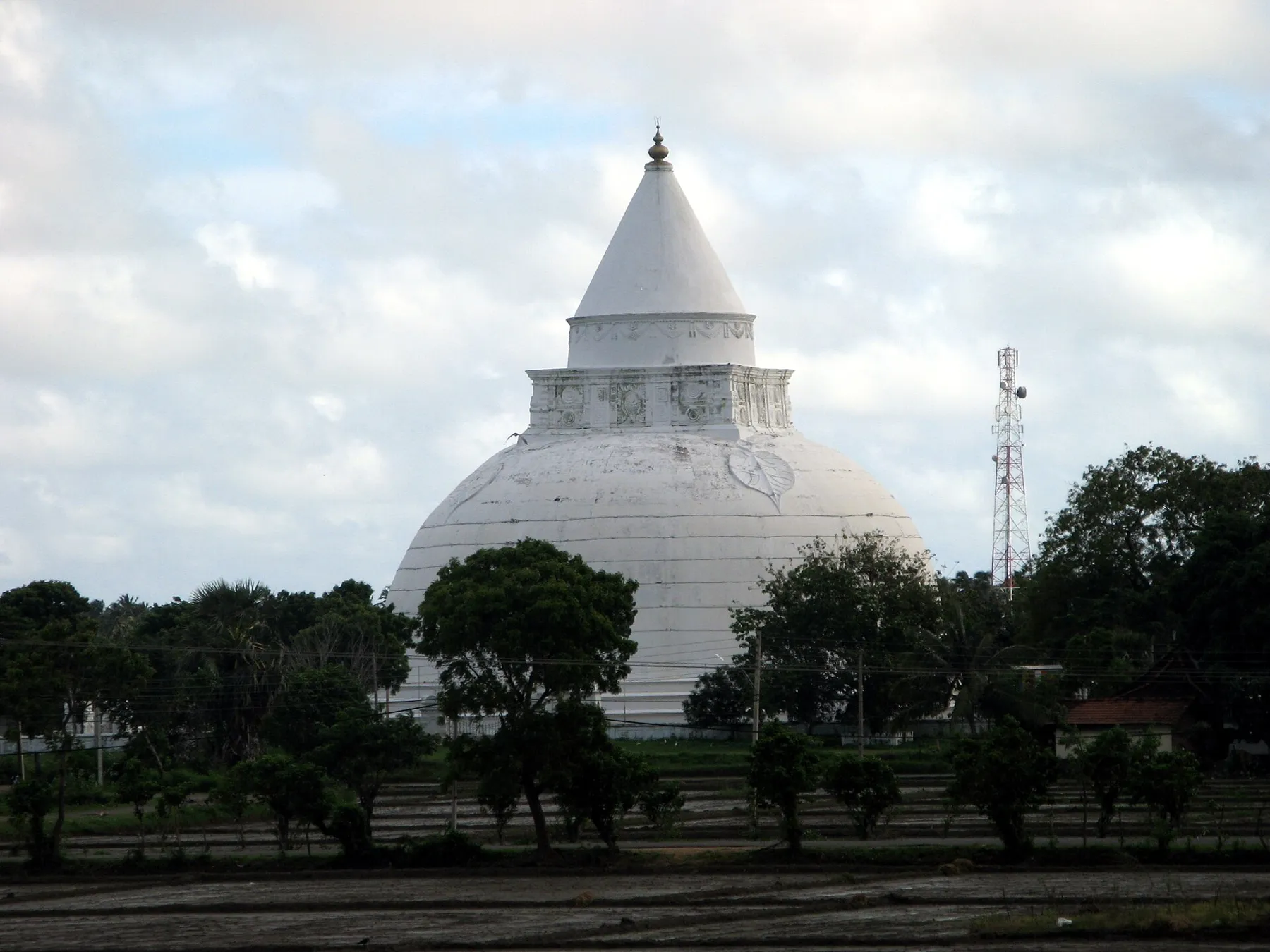
Quick answer: Yes, if you want a Yala safari or a visit to Kataragama. Tissamaharama, often called Tissa, sits on an ancient reservoir about 16 km by road from Palatupana on the Yala side and 17 km from Kataragama. The town also has one of the largest dagobas in Sri Lanka, which the local council dates to the 2nd century BC.
Tissamaharama is in Hambantota District in the Southern Province, inland from the coast. Our Hambantota page covers the port town on the coast to the west.
What is there to see in Tissamaharama?
The local council lists these sights on its website. The dates are the council's own.
| Sight | What the council says | Where |
|---|---|---|
| Tissamaharama Raja Maha Viharaya | Built by King Kavantissa of Ruhuna in the 2nd century BC. Its dagoba is "one of the largest" in Sri Lanka, with a bulbous shape | In town |
| Tissa Wewa | A reservoir thought to date to the 3rd century BC, built by Mahanaga of Ruhuna or his successor Yatala Tissa to water paddy fields and the old city | Beside the town |
| Sandagiri Viharaya | The council says the Ruhuna region was an important settlement from the 6th century BC, and that the chronicle Dathu Vamsa records a visit by the Buddha to Tissamaharama | Near the town |
| Kirinda Raja Maha Viharaya | A temple on a rocky hill with a view of the beach, the ocean and Kirinda harbour | On the coast south of town |
Tissamaharama dagoba
The white dagoba of the Raja Maha Viharaya is the town's landmark and you can see it from the reservoir road. It is an active temple, so dress for a temple visit: cover your shoulders and knees, and take off your shoes and hat inside. Our guide to visiting sacred sites has the full checklist. We found no official ticket price for the temple today, so we quote none.
Tissa Wewa
The council says the reservoir was built to supply water to the old city and its paddy fields. Its banks are an easy place for an evening walk, and the dagoba is close by.
How far is Tissamaharama from Yala and other places?
These are road distances and times from the centre of Tissamaharama on OpenStreetMap routes, checked on 21 October 2026. They assume no traffic, so allow more time.
| From Tissamaharama to | Distance | Time (no traffic) |
|---|---|---|
| Palatupana (Yala side) | about 16 km | about 25 min |
| Kataragama | about 17 km | about 20 min |
| Bundala National Park | about 21 km | about 30 min |
| Mattala airport (HRI) | about 29 km | about 35 min |
| Udawalawe | about 78 km | about 1 h 20 min |
| Tangalle | about 81 km | about 1 h 20 min |
| Ella | about 89 km | about 1 h 40 min |
| Mirissa | about 122 km | about 1 h 50 min |
| Colombo Fort | about 252 km | about 3 h 30 min |
Sri Lanka Tourism's Ramayana trail page gives Kataragama as 18.1 km from Tissamaharama, about 30 minutes, which is close to our figure.
Is Tissamaharama a good base for Yala?
Yes. It is the nearest town of its size to Palatupana, about 25 minutes away by road. The local council's Yala page notes that the park is home to the Sri Lankan leopard and holds the ruins of an old civilisation, including the Sithulpawwa monastery, which it says once housed 12,000 people about 2,000 years ago.
Park rules, gates and permits change, so we do not repeat them here. Read our Yala National Park page for the latest status, and compare it with Udawalawe in Udawalawe vs Yala or across four parks in our national parks comparison.
Safari day plan from Tissamaharama
A simple, printable plan for one safari day. Times are a pattern, not a park rule, so confirm the gate time with your jeep driver.
| Time | Plan |
|---|---|
| Early morning | Leave Tissa for the Palatupana side (about 25 minutes by road) |
| Morning | Safari, with water and a hat |
| Midday | Back in town for lunch and rest in the heat |
| Late afternoon | Walk along Tissa Wewa or visit the dagoba |
| Evening | Early night if you plan a second safari |
How do you get to Tissamaharama?
By road
The road is the main way in. From Colombo it is about 252 km, roughly 3.5 hours with no traffic, mostly on the expressway. From Ella it is about 89 km, and from Mirissa about 122 km.
By train
There is no railway to Tissamaharama. The Sri Lanka Railways fare table lists the last station on the coast line, Beliatta, at 183.23 km from Colombo Fort, with these fares:
| Class | Fare from Colombo Fort to Beliatta |
|---|---|
| 1st class | Rs 1,300 |
| 2nd class | Rs 650 |
| 3rd class | Rs 340 |
From Beliatta it is about 81 km to Tissamaharama by road, around 1 hour 15 minutes. We could not load an official train timetable today, so check times at the station. Our train booking and prices guide explains how to reserve seats.
By air
Mattala Rajapaksa International Airport (HRI) is about 29 km away. Two new winter routes land there, both checked on the airlines' own sites today:
| Airline | Route | Days | Season |
|---|---|---|---|
| Centrum Air | Tashkent to Mattala | Wednesdays and Saturdays | From 28 October 2026 to the end of March 2027 |
| Sunday Airlines (operated by SCAT Airlines) | Astana to Mattala | Wednesdays and Sundays | 28 October 2026 to 25 March 2027 |
Our direct flights guide also tracks the Russian charter flights planned for Mattala this winter. Kazakh citizens are on Sri Lanka's free-ETA list; Uzbek citizens are not, and the official ETA site lists USD 50 for a tourist ETA online. See the visa guide.
When is the best time to visit Tissamaharama?
The deep south is in the dry zone. The WMO 1991 to 2020 normals for Hambantota, the nearest weather station on the coast, show low rain for most of the year and a wet spell from October to December.
| Month | Rain (mm) | Rain days (1 mm or more) | Average high (°C) |
|---|---|---|---|
| January | 68.4 | 5.3 | 30.9 |
| February | 47.4 | 4.0 | 31.5 |
| March | 47.0 | 4.0 | 31.9 |
| April | 92.3 | 6.8 | 31.9 |
| May | 73.1 | 6.9 | 31.2 |
| June | 41.2 | 5.6 | 31.2 |
| July | 30.8 | 4.3 | 31.6 |
| August | 59.4 | 6.3 | 30.9 |
| September | 100.0 | 8.3 | 30.5 |
| October | 128.5 | 10.1 | 30.7 |
| November | 221.8 | 13.0 | 30.6 |
| December | 132.1 | 9.4 | 30.4 |
So February, March, June and July are the driest months. November is the wettest. Our Sri Lanka in November guide covers what that means across the island.
What is near Tissamaharama?
- Kataragama, about 17 km north. Our Kataragama sacred precinct page and the multi-faith pilgrimage guide explain the shrines. The Central Cultural Fund lists the Kataragama museum at USD 6 for a full ticket and USD 3 for a half ticket (prices updated 14 October 2026 at LKR 336 to the dollar).
- Bundala National Park, about 21 km west, on the coast.
- Udawalawe National Park, about 78 km away. See Udawalawe National Park.
- Tangalle, about 81 km west, for a beach stay. See Tangalle.
- Ella, about 89 km north. See Ella.
Frequently asked questions
Is Tissamaharama a good base for Yala?
Yes. Tissamaharama is about 16 km by road from Palatupana, on the Yala side of the town, around 25 minutes with no traffic on an OpenStreetMap route we checked on 21 October 2026. Kataragama is about 17 km away, so the town also works for a temple visit on the same trip.
How far is Tissamaharama from Kataragama?
About 17 km by road, around 20 minutes with no traffic on the OpenStreetMap route we checked. Sri Lanka Tourism's Ramayana trail page gives 18.1 km and about 30 minutes.
What is there to see in Tissamaharama?
The Tissamaharama Raja Maha Viharaya and its large white dagoba, which the local council says King Kavantissa of Ruhuna built in the 2nd century BC, and Tissa Wewa, a reservoir it dates to the 3rd century BC. The Sandagiri and Kirinda temples are nearby, and Yala and Bundala are the main parks.
How do you get to Tissamaharama from Colombo?
By road is simplest: about 252 km and 3.5 hours with no traffic on the OpenStreetMap route we checked, mostly on the expressway. There is no train to the town. The nearest station, Beliatta, is 183.23 km from Colombo Fort on the Sri Lanka Railways fare table, and about 81 km from Tissamaharama by road.
Which airport is closest to Tissamaharama?
Mattala Rajapaksa International Airport (HRI), about 29 km by road. This winter Centrum Air says it will fly Tashkent to Mattala on Wednesdays and Saturdays from 28 October 2026, and Sunday Airlines lists Astana to Mattala on Wednesdays and Sundays from 28 October 2026 to 25 March 2027. Most international flights still land at Colombo.
When is the best time to visit Tissamaharama?
February to March and June to July are the driest months on the WMO 1991 to 2020 normals for nearby Hambantota, each under 50 mm of rain. November is the wettest month at 221.8 mm. It is warm all year, with average highs of about 30 to 32°C.
How far is Tissamaharama from Ella?
About 89 km by road, around 1 hour 40 minutes with no traffic on the OpenStreetMap route we checked. That makes Ella and a Yala safari an easy pair on one route.
Do you need a ticket for the Tissamaharama dagoba?
We found no official ticket price for the Tissamaharama Raja Maha Viharaya today, so we quote none. It is an active Buddhist temple, so wear clothes that cover your shoulders and knees, and take off your shoes and hat inside the grounds.
Sources
Last verified 2026-10-21
- https://tissamaharama.ps.gov.lk/thingstosee/tissamaharama-rajamaha-viharaya/
- https://tissamaharama.ps.gov.lk/tissa-wewa/
- https://tissamaharama.ps.gov.lk/thingstosee/sandagiri-viharaya/
- https://tissamaharama.ps.gov.lk/thingstosee/kirinda-viharaya/
- https://tissamaharama.ps.gov.lk/yala-national-park/
- https://www.srilanka.travel/ramayanaya/places.php
- https://ccf.gov.lk/is/index.php
- https://www.railway.gov.lk/web/images/pdf/Ticket_Price_Line/main_line/1_fot.pdf
- https://centrum-air.com/en/news
- https://sundayairlines.kz/en/news/pryamye-reysy-astana-sri-lanka-mattala/
- https://www.ncei.noaa.gov/data/oceans/archive/arc0216/0253808/2.2/data/0-data/Region-2-WMO-Normals-9120/SriLanka/CSV/
- https://www.openstreetmap.org/
Plan your Tissamaharama trip
Direct Flights to Sri Lanka from the UK, Europe, India and Australia
Yes: SriLankan sells London Heathrow to Colombo, and British Airways starts London Gatwick to Colombo on 23 October 2026, three times a week. India, Australia and Germany routes from the airlines' own pages, checked 15 October 2026.
Sri Lanka in November
November is one of Sri Lanka's wetter months island-wide, and the Department of Meteorology expects above-normal rain in November 2026. How to plan around it, where to go, and what opens, checked 12 October 2026.
Sri Lanka's National Parks Compared
Compare Yala, Udawalawe, Wilpattu and Minneriya using official 2025 visitation, permit rules and route-fit questions rather than sighting promises.
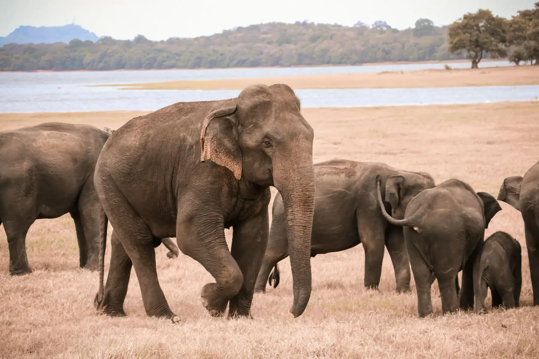
Udawalawe or Yala?
Choose Udawalawe if elephants and a quieter park matter most; choose Yala if leopards are the priority and you accept heavier crowds. Yala Blocks 1 and 2 reopen 16 October 2026.
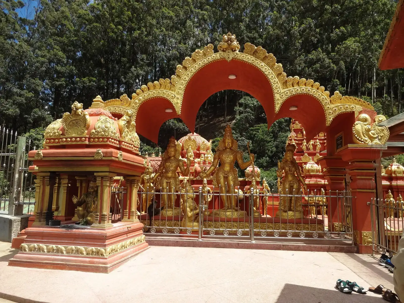
Ramayana Trail in Sri Lanka: 10-Day Itinerary
A 10-day Ramayana trail by road, built from Sri Lanka Tourism's own list of sites: Munneswaram and Manavari near Chilaw, Koneswaram and Kanniya in Trincomalee, Ramboda, Seetha Eliya and Divurumpola in the hills, Ravana Cave near Ella, Kataragama, Ussangoda and Rumassala, ending at Kelaniya. Road times and temple hours checked 21 October 2026.