Hill Country and South Coast: 8-Day Itinerary
Eight days from Colombo airport to Kandy, Nuwara Eliya and Ella, then down to the south coast at Mirissa and Galle. Road times for every leg, rain by month for each stop, the Navy whale cruise price and a printable day plan. Checked 22 October 2026.
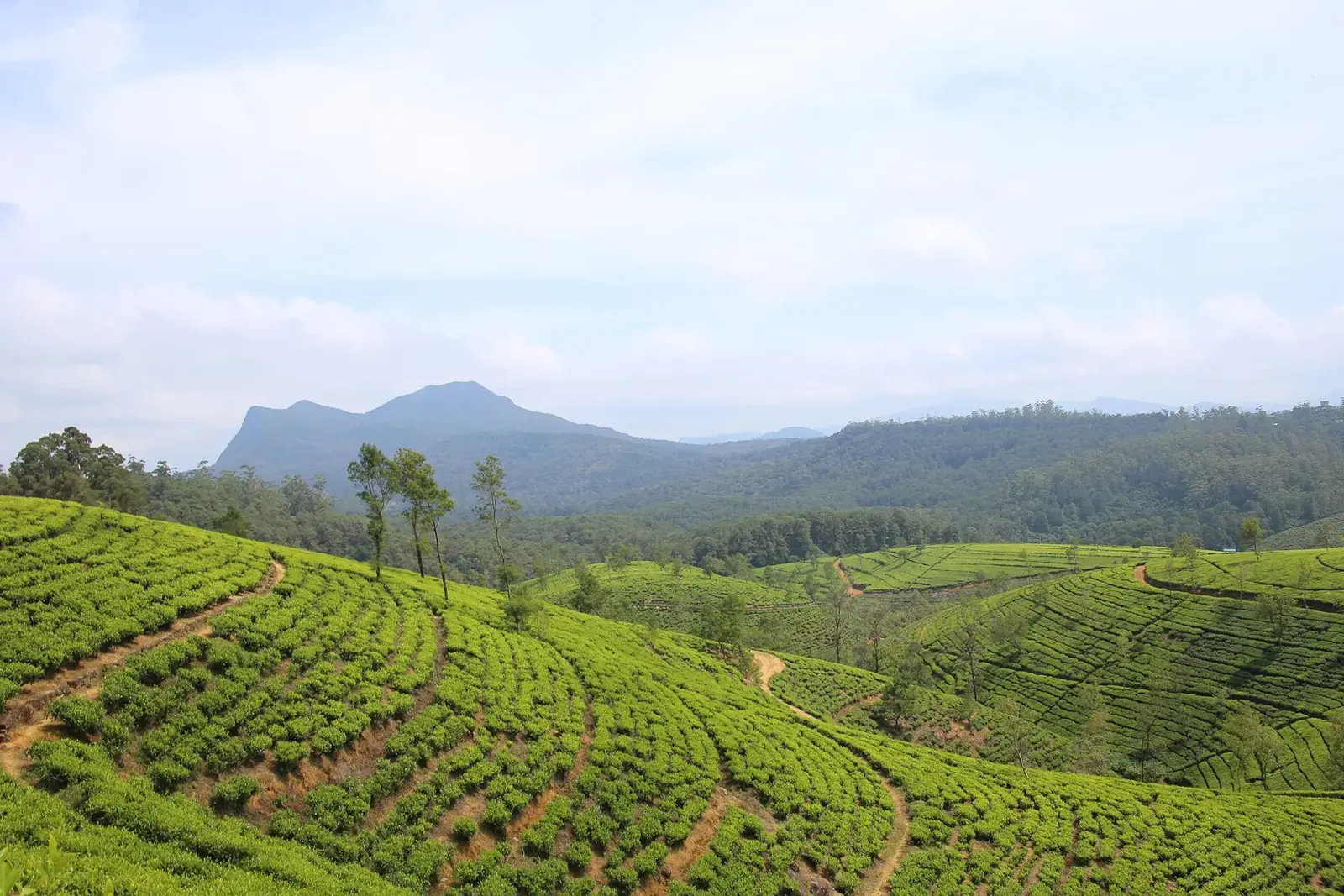
Day by day
- Day 1
Kandy
Two nights. About 101 km from Colombo airport, around 2 hours by road.
- Day 3
Nuwara Eliya
One night. About 71 km from Kandy, around 1 hour 35 minutes by road.
- Day 4
Ella
Two nights. About 63 km from Nuwara Eliya. Check our Nanu Oya to Ella train guide before planning a rail leg.
- Day 6
Mirissa
Two nights. About 178 km from Ella, around 2 hours 54 minutes. Whale cruises run November to April.
- Day 8
Galle
Morning in Galle Fort, about 33 km from Mirissa, then about 151 km to Colombo airport.
What does an 8-day hill country and south coast trip look like?
Quick answer: Spend two nights in Kandy, one in Nuwara Eliya, two in Ella and two on the south coast at Mirissa, then see Galle Fort on the way to the airport. That is about 597 km of road in 8 days, and the longest drive is Ella to Mirissa, about 3 hours. January to March is the driest time for both the hills and the coast.
This route is for people who want both tea country and beach time without crossing the island twice. If you have more time, see our two-week itinerary. If you want the hills only, see hill country and tea country.
Hill-country caution (23 October 2026): the Disaster Management Centre asked travellers to reconsider non-essential hill-country trips amid rain and landslide risk, and to check 117 and the Met forecast before setting out. Unsettled rain may continue into late October. This page does not claim the hill roads on this itinerary are closed. See Sri Lanka in October.
What is the day-by-day plan?
| Day | Route | Distance and time (no traffic) | Night |
|---|---|---|---|
| 1 | Colombo airport to Kandy | 101 km, 1 h 59 min | Kandy |
| 2 | Kandy: Temple of the Tooth, lake, city | Local | Kandy |
| 3 | Kandy to Nuwara Eliya | 71 km, 1 h 35 min | Nuwara Eliya |
| 4 | Nuwara Eliya to Ella | 63 km, 1 h 26 min | Ella |
| 5 | Ella: Nine Arch Bridge, Little Adam's Peak | Local | Ella |
| 6 | Ella to Mirissa | 178 km, 2 h 54 min | Mirissa |
| 7 | Mirissa: whales (Nov to Apr) or beach, Weligama 5 km away | Local | Mirissa |
| 8 | Mirissa to Galle Fort, then the airport | 33 km, 36 min; then 151 km, 2 h 00 min | Fly home |
Road times are from OpenStreetMap with no traffic, checked 22 October 2026. Real times in the hills are often longer, so leave early on day 6.
Day 1 and 2: Kandy
Land, then drive about 2 hours to Kandy. On day 2, visit the Temple of the Sacred Tooth Relic and walk around the lake. Dress with shoulders and knees covered; see what to wear in Sri Lanka.
Day 3: Nuwara Eliya
It is about 71 km up into the tea country. Nuwara Eliya is cool all year: WMO normals show average highs of about 19 to 22 °C. Stop at a tea estate on the way.
Day 4 and 5: Ella
Drive about 63 km to Ella. On day 5, walk to the Nine Arch Bridge and up Little Adam's Peak. If you want a train ride, our Nanu Oya to Ella train guide shows what is running before you book.
Day 6 and 7: Mirissa
Day 6 is the long drive, about 178 km down to Mirissa. Day 7 is free: from November to April, take a whale-watching boat. The Sri Lanka Navy cruise from Galle Harbour costs USD 80 for a foreign adult, including USD 20 tax, and USD 40 for a child aged 6 to 12 (checked 22 October 2026). Or take a surf lesson in Weligama, 5 km away.
Swap: stay in Tangalle instead to cut the drive from Ella to about 138 km (2 h 25 min). Our Weligama vs Mirissa vs Tangalle guide compares the three.
Day 8: Galle Fort and home
Drive about 33 km to Galle Fort, a UNESCO World Heritage Site that UNESCO calls the best example of a fortified city built by Europeans in South Asia. Walk the ramparts, then allow about 2 hours for the 151 km to the airport, plus check-in time.
When is the best time to do this route?
WMO 1991 to 2020 rain normals (mm) for each stop:
| Month | Kandy (Katugastota) | Nuwara Eliya | Ella (Badulla) | Mirissa (Galle) | Verdict |
|---|---|---|---|---|---|
| January | 103.2 | 115.6 | 183.6 | 86.8 | Good |
| February | 78.1 | 72.7 | 102.3 | 71.1 | Best |
| March | 97.6 | 72.2 | 87.6 | 89.9 | Best |
| April | 189.1 | 133.5 | 183.5 | 201.9 | Mixed |
| May | 141.2 | 171.7 | 120.0 | 315.9 | Coast wet |
| June | 124.5 | 168.3 | 51.6 | 184.0 | Coast wet, no whales |
| July | 108.0 | 155.0 | 54.0 | 172.6 | Coast wet, no whales |
| August | 95.4 | 132.4 | 72.2 | 161.9 | Coast wet, no whales |
| September | 123.5 | 161.2 | 106.7 | 260.9 | Wet |
| October | 303.3 | 246.6 | 242.1 | 344.5 | Wettest |
| November | 268.9 | 226.4 | 285.7 | 282.6 | Wet |
| December | 203.6 | 182.9 | 269.9 | 175.9 | Coast drying |
From May to September the south-west coast is wet and rough. In those months, swap the coast for the east; see our east coast vs south coast guide.
Printable day plan
| Day | Morning | Afternoon | Evening |
|---|---|---|---|
| 1 | Land, drive to Kandy | Rest | Kandy lake walk |
| 2 | Temple of the Tooth | City and market | Kandy |
| 3 | Drive to Nuwara Eliya, tea estate stop | Town walk | Cool night, warm layer |
| 4 | Drive to Ella | Settle in | Ella |
| 5 | Little Adam's Peak at sunrise | Nine Arch Bridge | Ella |
| 6 | Leave early for the coast | Arrive Mirissa | Beach |
| 7 | Whale boat (Nov to Apr) or surf | Beach | Mirissa |
| 8 | Galle Fort ramparts | Drive to the airport | Fly |
For the Ella to coast day, our Mirissa to Ella transport guide has bus fares and places to stop, including Wellawaya for Buduruwagala.
Frequently asked questions
Is 8 days enough for the hill country and the south coast?
Yes, if you keep it to five stops. This plan gives Kandy and Ella two nights each, Nuwara Eliya one, and two nights on the coast at Mirissa, with Galle Fort on the last morning. Adding Sigiriya would need two or three more days.
What is the total driving in this itinerary?
About 597 km on the OpenStreetMap routes we checked on 22 October 2026, with the longest leg Ella to Mirissa at about 178 km (2 hours 54 minutes with no traffic).
Can you take the train from Kandy to Ella?
Check the current status before you plan it. Our Kandy to Ella train guide tracks what is running section by section. This itinerary uses the road between Kandy, Nuwara Eliya and Ella so it works either way.
What is the best time of year for this route?
January to March. On the WMO 1991 to 2020 normals, that is the driest stretch for both Galle on the coast (71 to 90 mm a month) and Nuwara Eliya in the hills (72 to 116 mm). October and November are the wettest months at most of the stops.
Can you see whales on this route?
Yes, from November to April. The Sri Lanka Navy runs a whale cruise from Galle Harbour for USD 80 for a foreign adult, including USD 20 tax, and many private whale-watching boats leave from Mirissa harbour.
Should you stay in Mirissa or Tangalle on this route?
Mirissa is closer to Galle and the airport for the last day. Tangalle is about 40 km closer to Ella (138 km against 178 km) and quieter. Our Weligama vs Mirissa vs Tangalle guide compares them.
How cold is Nuwara Eliya?
Cool. WMO normals for Nuwara Eliya show average highs of about 19 to 22 °C and lows of about 10 to 13 °C through the year, so pack a warm layer.
Can you do this route in reverse?
Yes. Start on the coast at Galle and Mirissa, then drive up to Ella, Nuwara Eliya and Kandy, and finish with the 101 km run to the airport from Kandy.